KATHMANDU, July 9: The Flood Forecasting Division under the Department of Hydrology and Meteorology has begun investigating the cause of the flood that occurred in Rasuwa's Bhotekoshi River in the early hours of Tuesday.
Binod Parajuli, head of the division, stated that the Tibetan region of the Bhotekoshi watershed contains several glacial lakes. To identify the possible cause of the flood and assess its impact along the riverbanks, satellite imagery is now being analyzed.
Parajuli said preliminary observations and data from weather centers suggest that the flood was not triggered by heavy rainfall.
Form high-level committee to identify causes of self-immolation...

He explained, “The weather stations at Kyanjin, near the Chinese border, and at Dhunche reported only light rain. Similarly, the weather radar in Palpa showed no significant precipitation along the border areas of Rasuwa.”
According to satellite-based rainfall estimates from the World Meteorological Organization’s guidance system, there was no measurable rainfall in the Bhotekoshi watershed area over the past 24 hours, further weakening the assumption that rain caused the flood.
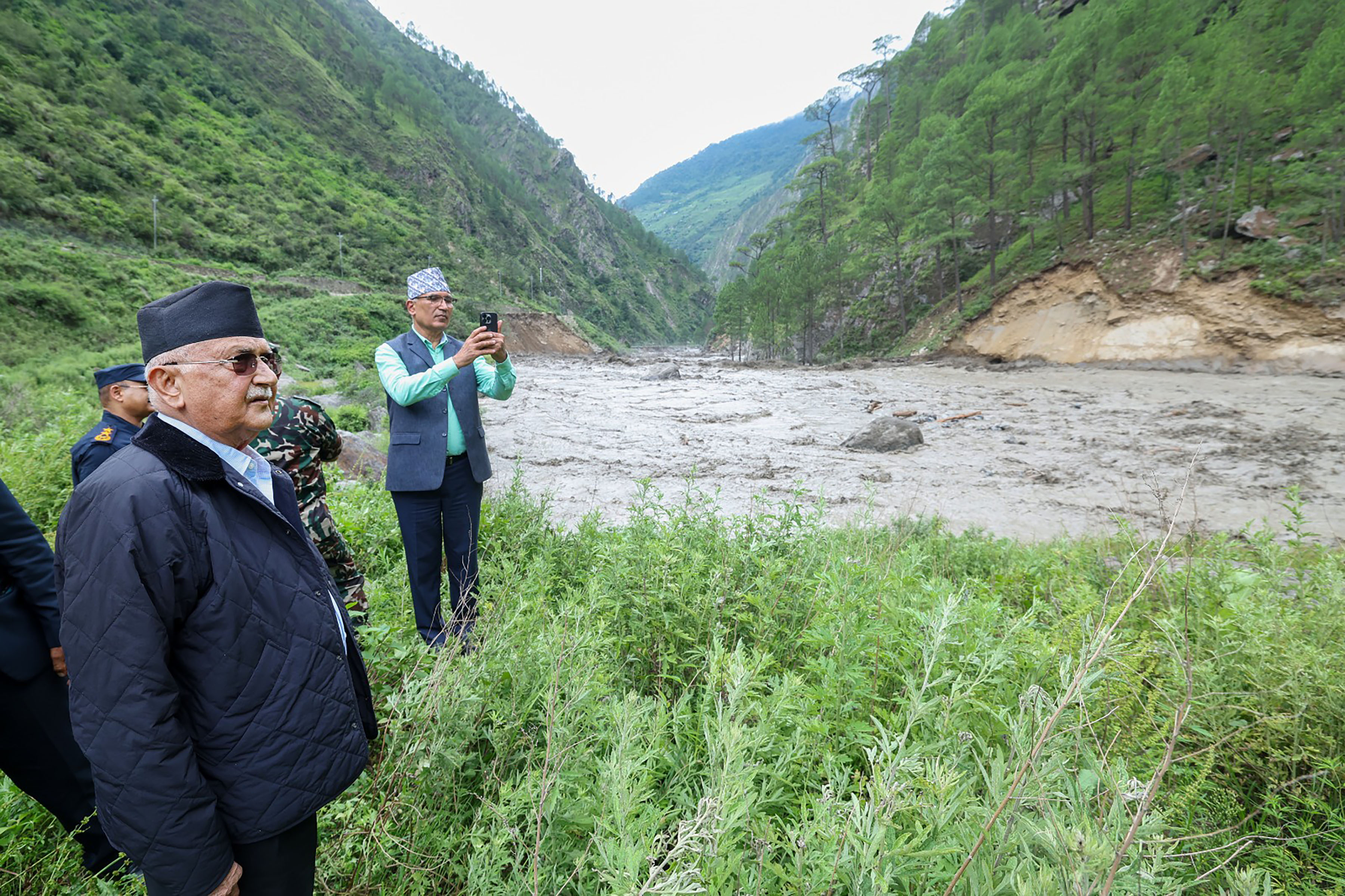
The flood struck suddenly around 3 a.m. yesterday as water surged from Tibet into the Bhotekoshi River. The river's level rose by 3.5 meters in Timure, Rasuwa, Parajuli said.
He added that the flood had a severe impact along the Bhotekoshi and Trishuli riverine in Rasuwa, a moderate impact in Nuwakot, and a minor effect as far downstream as Benighat in Dhading.
Although the water level is now receding, Parajuli urged the public to remain cautious. The flood swept away 64 vehicles, including cargo trucks, and 55 people were rescued and moved to safer locations. Seven people have been confirmed dead, and 18 others remain missing.


-1200x560_20211129172901.jpg)