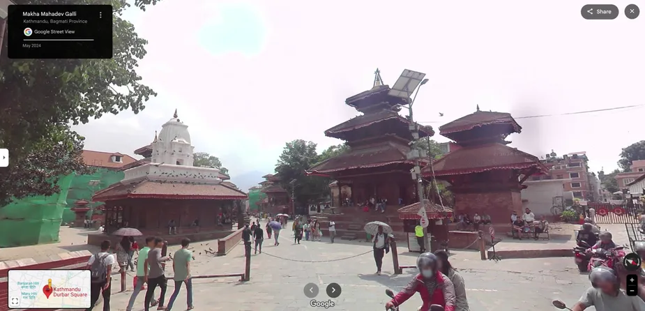
KATHMANDU, Aug 15: Google has rolled out its Street View feature in Nepal, allowing anyone with a phone or computer to explore Kathmandu’s bustling alleys, the Terai’s plains and roads, snow-capped Himalayan peaks through immersive, 360-degree panoramas. Users can access the newest imagery by opening Google Maps and selecting the 360° layer or dragging the yellow “Pegman” onto the map.
Google’s announcement in a blog post on Friday highlights the new feature’s ability to “immerse” in Nepal’s architectural heritage — from ancient temples to lively markets — as well as to virtually navigate urban streets and scenic highways, expanding how residents, tourists and the Nepali diaspora can preview places, plan trips and share locations.
Google Voice is getting an upgrade

How to use it
On desktop or mobile, open Google Maps, search for a location in Nepal and either tap the 360° view or drag Pegman onto a highlighted street or place to start exploring. The feature is live from Friday.
Street View adds a visual layer to maps that can support wayfinding, trip planning and storytelling for tourism, culture and local businesses by showing what places actually look like at street level. Nepal joins a growing list of countries with Street View road coverage, a step up from earlier imagery that focused mainly on landmarks and trekking routes.
Before its nationwide rollout on Friday, Nepal appeared in Street View primarily through special projects in the Everest/Khumbu region. This project included imagery of Everest Base Camp to the south and surrounding trails captured in the early 2010s. These efforts, done with lightweight panoramic rigs and local partners, offered the first taste of Nepal in Street View but did not include broad road coverage across cities and highways.